Is Ol Doinyo Lengai Safe to Climb? Tanzania's Most Active Volcano
11th November, 2026
67
Tanzania’s Ol Doinyo Lengai, the “Mountain of God,” is unlike any other volcano on Earth. It’s the only one known to erupt natrocarbonatite lava, which is cooler than typical lava and can turn from black to white within days or even hours.
Its unique geology leads many to want to scale Ol Doinyo Lengai, but as it's an active, erupting volcano, is it safe to climb? In the dry season, with a local guide and the right preparation, it’s safe to climb Ol Doinyo Lengai.
This guide covers where it is, whether it's active, when it last erupted, the real risks, and how hard the climb is, so you can decide if it's right for you.
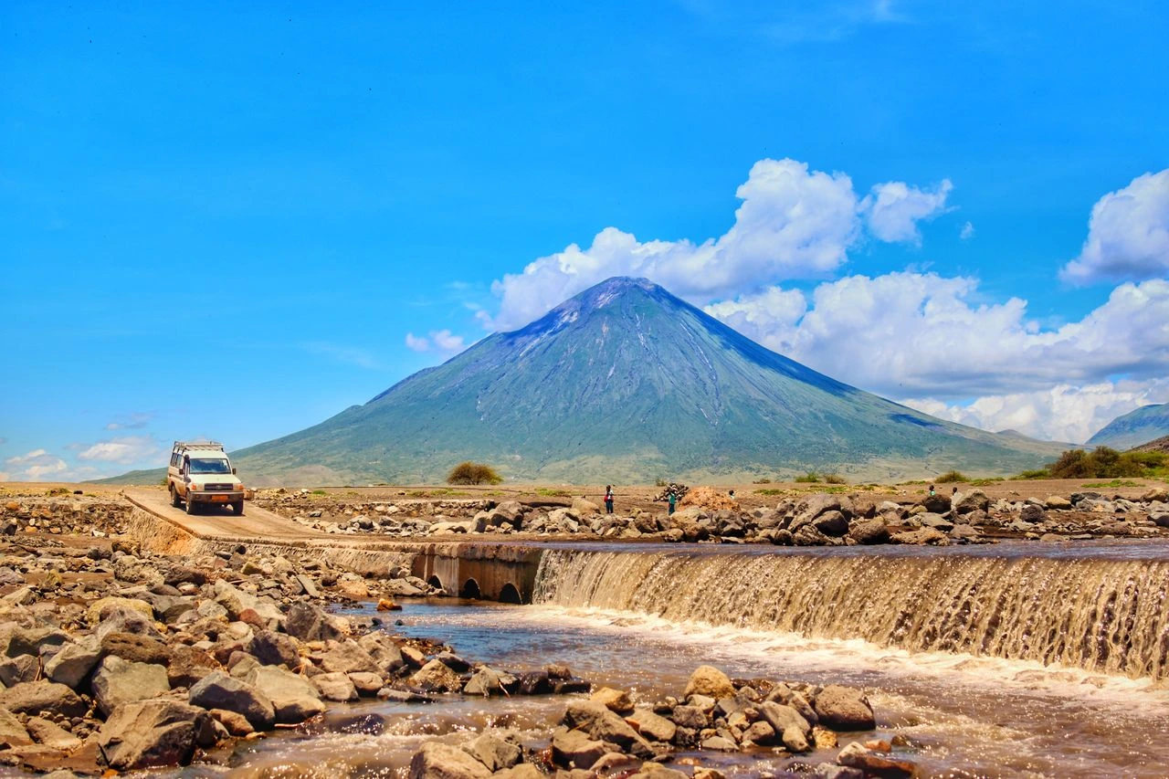
Ol Doinyo Lengai on a sunny day.
Ol Doinyo Lengai Key Facts
Name: Ol Doinyo Lengai means “Mountain of God” in the Maasai language
Height: 2,962 m / 9,718 ft
Type: A stratovolcano with one cone and two craters. It’s the only volcano known to erupt natrocarbonatite lava, a low-temperature, highly fluid magma containing rare sodium and potassium carbonate minerals
Location: Arusha Region, northern Tanzania, at the southern end of Lake Natron
Status: Active; its ongoing eruptive period began in April 2017 (Smithsonian GVP).
Climb: Overnight ascent, steep ash and rock terrain, no huts, round-trip usually completed within 12 hours
Land: Protected as part of the Ngorongoro Lengai UNESCO Global Geopark. It’s sacred Maasai community land and not part of a national park or conservation area.
Where Is Ol Doinyo Lengai?
Ol Doinyo Lengai is a freestanding mountain that rises as an almost perfectly symmetrical cone from the savanna of northern Tanzania’s Arusha Region, approximately 70 km (43 mi) from the Kenya border. It lies about 16 km (10 mi) south of Lake Natron and 50 km (31 mi) north of the Ngorongoro Crater’s rim.
Ol Doinyo Lengai is along the Gregory Rift, the eastern branch of the East African Rift System between the Somali and Nubian tectonic plates, which is also responsible for the formation of Mount Kilimanjaro and the Ngorongoro Volcanic Highlands.
Arusha, the nearest major city to Ol Doinyo Lengai, is located roughly 110 km (68 mi) southeast of Ol Doinyo Lengai as the crow flies. The route from Arusha to Ol Doinyo Lengai is to drive from Arusha to Mto wa Mbu, then drive a 4x4 north along dirt roads past Engaruka. You’ll use Engare Sero as a base for your climb. The journey from Arusha to Ol Doinyo Lengai is about 200 km (124 mi) and takes about half a day.
Is Ol Doinyo Lengai Active?
Yes, Ol Doinyo Lengai is active. Its last major explosive eruption was in September 2007, when 2 to 15 km (1.2 to 9 mi) high eruption columns burst from Ol Doinyo Lengai after 25 years of minor overflow eruptions. The eruption created a new 100 m (330 ft) deep and 300 m (980 ft) wide crater and spread ash over 100 km (62 mi). Three nearby villages were evacuated. These eruptions continued into 2008.
As of March 2026, Ol Doinyo Lengai is in an eruptive phase that began in April 2017. It’s a low-level eruptive phase, mainly characterized by a bubbling natrocarbonatite lava lake, small lava flows, and sulfurous gas emissions, along with the occasional spattering deep within the northern cone.
This ongoing eruptive phase means that Ol Doinyo Lengai is more dangerous to climb than a dormant volcano. However, as long as you use an official guide, obey crater boundaries, and stay clear of active lava pools, the risk is pretty low. Increased monitoring by geoscientists means Ol Doinyo Lengai is monitored more closely than ever before, reducing the chances of a major eruption without warning.
Is Ol Doinyo Lengai Tanzania’s only active volcano?
No, Ol Doinyo Lengai isn’t Tanzania’s only active volcano. But it’s by far the most active. According to the United States Geological Survey (USGS), volcanologists consider any volcano that erupted within the Holocene geologic epoch (last 11,650 years) to be active.
Mount Meru, which last erupted in 1910, and Kyejo, which last erupted in 1800, are both generally considered to be active volcanoes. Ol Doinyo Lengai is the only Tanzanian volcano to have erupted in the last century.
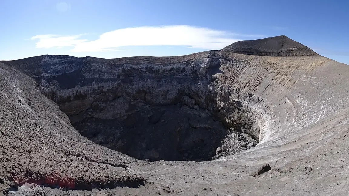
One of Ol Doinyo Lengai's two craters.
What Type of Volcano Is Ol Doinyo Lengai?
Ol Doinyo Lengai is a stratovolcano with one cone and two craters that erupts rare natrocarbonatite lava. It’s the only active volcano worldwide to erupt natrocarbonatite lava, making it one of the world’s most unique volcanoes.
Natrocarbonatite lava has an unusually low temperature (500°C to 600°C) compared to typical silicate lava (around 1,100°). The temperature is so low that it appears black in sunlight rather than the glowing red usually associated with lava flow.
Within a few hours of erupting, natrocarbonatite lava turns from black/brown to white because of its chemical instability and reaction with moisture in the air. Ol Doinyo Lengai’s lava matters for safety because its color can be deceptive and can cause burns, even though it looks cooler than typical lava flows.
Ol Doinyo Lengai’s lava is also much more fluid than silicate lavas, partly because of its low silica content. Silica gives lava its thick, viscous consistency. Ol Doinyo Lengai’s lava is the least viscous on the planet.
Ol Doinyo Lengai’s lava is interesting but unlikely to cause fatalities; toxic fumes, explosive eruptions, and falls while climbing are much greater risks.
Is Ol Doinyo Lengai Safe to Climb?
Ol Doinyo Lengai is an active volcano, so climbing it comes with its own inherent risks. But as long as you take the right precautions, monitor volcanic activity, and listen to your guide, it's considered safe to climb. Ol Doinyo Lengai is climbed regularly by dozens of tour operators, including Safari Soles, despite being active.
The real risks are not the ones most people picture. Lengai's lava is unusually cool compared with most volcanoes (around 500°C versus about 1,100°C), and eruptions here are mostly effusive rather than explosive. The more common problems are the terrain, the heat, and the weather.
The main risks and how they're managed
Risk
What to know
How it's managed
Volcanic activity
Lava, gas, and occasional explosive episodes are possible, and conditions can change between climbs.
Guides check recent activity before every climb and can change or cancel the plan.
Loose, steep terrain
Slipping on loose ash and rock is the most likely way to get hurt, and the descent is harder than the ascent.
Sturdy boots, a steady pace, and a guide who sets the route. Essential gear like helmets, poles, and gloves.
Heat
The Rift Valley floor regularly tops 30°C (86°F) in the daytime.
The climb starts at night, so you do the hardest part at cooler temps
Weather
Rain makes slopes slick and the drive to the base difficult.
Climb in the dry season, roughly June to October.
Fitness
It is a long, strenuous effort, not a casual hike.
Honest fitness check before booking. Ol Doinyo Lengai usually takes 9 to 12 hours to climb round-trip.
A simple go/no-go test
Climb if all of these are true:
You're going in the dry season with an official local guide (never unguided)
Your guide has confirmed the crater is stable enough that day
You've arrived rested, ideally the day before
You're comfortable with a steep, loose descent
Who should skip it
Ol Doinyo Lengai isn't a good fit for first-time hikers, anyone with knee, heart, or breathing problems, or anyone who doesn't like exposed, loose footing. Hikers with breathing conditions like asthma may struggle to breathe due to sulfur gas emissions. Mid- to high-fitness levels are required, and you should train for several weeks beforehand by climbing local hills or walking uphill at a gradient for several hours at a time.
If you're unsure, check with your doctor and talk to us before you book. We'll steer you toward an easier alternative if the climb isn't right for you.
Finally, the mountain is sacred to the Maasai, who call it the "Mountain of God." Following your guide's lead, including the call to turn back, is part of climbing it safely and respectfully.
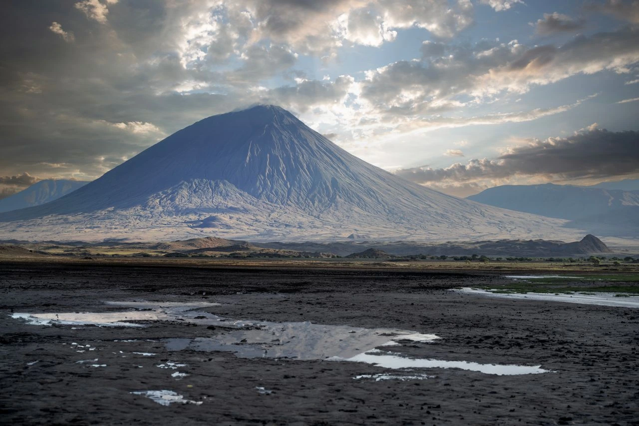
Ol Doinyo Lengai from the north near Lake Natron on a cloudy day.
Is Ol Doinyo Lengai Difficult to Climb?
Ol Doinyo Lengai is considered one of the most difficult and physically demanding day hikes in East Africa. You’ll climb relentlessly uphill, with the gradient getting steeper with elevation and exceeding 45° on the upper slopes. Because of high daytime temperatures on the valley floor, you’ll start your climb around midnight, climbing over loose ash and rugged terrain in the dark. That said, at 2,962 m, you won't have to worry about altitude sickness, and the climb isn’t technical.
Compared to Kilimanjaro, Ol Doinyo Lengai is more demanding hour-on-hour because of its gradient, footing, and changeable temperatures. However, because of its length and the challenges of high altitude, Kilimanjaro is a much more difficult hike overall.
If you’re looking to build fitness and confidence, consider climbing a less physically demanding nearby summit, like Mount Meru, first.
When Is It Safest to Climb Ol Doinyo Lengai?
The safest time to climb Ol Doinyo Lengai is during the dry season, from June to October. The slopes are firmer, the skies are clearer for sunrise at the summit, and the drive to the base is far easier. January and February are also good times to climb Lengai, but conditions are less predictable.
Avoid March to May. Heavy rain makes the loose slopes slick, and the roads around Lake Natron can become difficult or impassable.
Even in the dry season, expect cool temperatures during the night climb and a quick warm-up after sunrise, so dress in layers.
How to Climb Ol Doinyo Lengai Safely With Safari Soles
The safest way to climb Ol Doinyo Lengai is with a local guide who knows the mountain and has the authority to call off the climb. Every Safari Soles climb is led by experienced official guides, who check the crater's recent activity before you set off and make the final go or no-go decision on the day.
We also build time into our itineraries for travel and recovery. We’d recommend a 3-day itinerary which includes arranged travel from Arusha to Ol Doinyo Lengai, rest time before the climb, and recovery time after.
Safari Soles recommends: Combine the climb with Lake Natron and the wider northern circuit for a trip that's safer, less rushed, and far more rewarding.
Ready to plan your Ol Doinyo Lengai adventure? Contact our team, and we'll check conditions, confirm the best dates, and tell you honestly whether the climb is right for you.